Plenary Sessions
Spatial Analytics and Business Intelligence
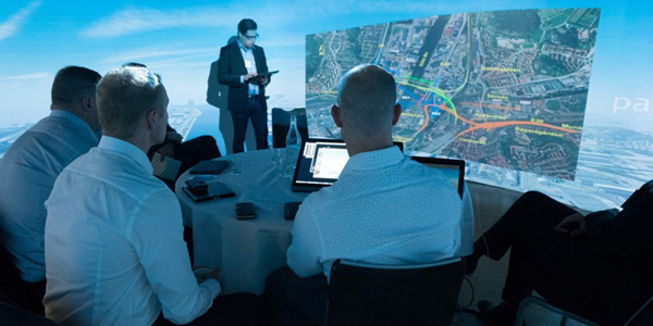
Geospatial moving beyond visualisationSpatial analytics is more than simply understanding the physical location of key assets on a map. It's about gaining a richer perspective on service offerings, consumer interaction, transactional information, and how location and demographics play a role in the organization's performance. Systematically analyzing relationships between the spatial environment and organizational performance offers a wealth of information; yet, many analysts struggle with spatial analytics because it requires them to blend geospatial data with traditional data sets. Most existing business intelligence and spatial analytics tools simply display spatial data on a map, leaving the analysis between operational data and location to the user. The session will focus on the relationship between spatial analytics and business intelligence with special emphasis on the following points.
Discussion points- Trends and forecast of Business Intelligence market
- Technology innovations driving Spatial Analytics industry
- Value of spatial analytics/GIS for Business Intelligence applications
- Use cases of applying spatial analytics and BI in various vertical domains including utilities, oil and gas, municipalities etc.

Emerging Technologies and Future Trends
Geospatial Industry is impacted by a plethora of technologies today more than ever. Internet-of-Things, Cloud Computing, Big Data, Deep Learning and Artificial Intelligence, Virtual Reality, Sensor based technologies all play a significant role in shaping the way we produce, process and consume spatial information. With the increase in number of users for spatial information and technologies, especially as they become more precise in their demands and sophisticated in their use of spatial data, it's indeed a good news that our industry is supported by these emerging technologies that make integration of spatial information with other systems faster, efficient and precise. This Plenary will divulge for the audience some of these trends and how they impact our work today.
Discussion points- Trends and forecast of emerging technologies
- Technology innovations driving the geospatial industry
- Value and utility of geospatial technology (hardware and software) for vertical industries
- Use cases highlighting integration of geospatial with other systems and processes
Workshop

Workshop on Defence and Security
Geospatial information and technologies play a crucial role in ensuring National Safety and Security. With advancements in sensor based technologies, improvements in deriving precise location information in real-time, higher processing capabilities through machine learning and Artificial Intelligence, advancements in data analytics tools, the nature of modern warfare and security services is changing rapidly. The workshop on Defence and Security during Oman Geospatial Forum will highlight some of the modern tools and techniques available today with the defence and security personnel and how they can ensure efficient functioning for Command, Control, Communications, Computers, Cyber, Intelligence, Surveillance and Reconnaissance (C5ISR) capabilities in Oman.
Target Audience:- Border Controls
- Civil Defence Departments
- Consultants
- Customs Officials
- Defence Forces - Army, Navy, Air Force
- Defence System Integrators
- Disaster Management Authorities
- Fire Services
- Geospatial Technology Providers
- Police Force
Seminar

Value of Geospatial Technologies for National Economy
Embedment of geospatial in business processes furthering economic valueIn an effort to trace the impact that geospatial technologies are creating in domains that run economies, these sessions will involve presentations by speakers from user domains including defense and security, disaster management, utilities, building and construction, agriculture, retail and banking and other location based services that will very succinctly and precisely share success stories and case studies where in geospatial technologies have brought in substantial return-on-investments for their organizations and helped them achieve their organizational goals in better, faster and more economical ways.
Discussion points- Elucidate success stories of geospatial technologies in various verticals
- Discuss the technology trends and ways in which geospatial technology integrates with other business processes
- Value and utility of geospatial technology in various vertical domains
- Identify ways to assess and display the value to decision makers